Province of Camarines Sur
Provincial Profile
Discover the rich history, geography, and demographics of our beloved province.
Explore DetailsTable of Contents
548k+
Total Hectares
Land Area
The Governor
Luis Raymund “LRay” Villafuerte Jr.
With an unwavering commitment to serve the people of Camarines Sur, Governor Luis Raymund “LRay” Villafuerte Jr. has dedicated his life to uplifting the province through dynamic leadership and forward-looking programs. A graduate of the prestigious University of the Philippines, he honed his knowledge and skills to prepare himself for public service, which later paved the way for his groundbreaking projects in governance.
During his first three terms as Governor from 2004 to 2013, he championed development programs that energized the local economy and improved the quality of life for every Camarinense. His leadership in the House of Representatives as Congressman of the 2nd District (2016–2025) and as Deputy Speaker of the 18th Congress further strengthened his voice in shaping policies for national and local progress.
Now, as he returns as the newly elected Governor of Camarines Sur in 2025, Governor LRay brings with him a renewed vision and proven experience. With a heart for innovation and genuine public service, he is set to lead the province toward even greater growth and opportunities for all.
LOCATION
Camarines Sur is located in the central part of the Bicol Peninsula, the southeastern part of Luzon Island. It is located between 140 10' and 130 15' North Latitude and between 1240 10' and 1220 40' East Longitude. It is bounded on the north by the province of Quezon and Camarines Norte, San Miguel Bay, and the Pacific Ocean. On its south is the province of Albay, its east the Lagonoy Gulf, and its west the Ragay Gulf.
Topography
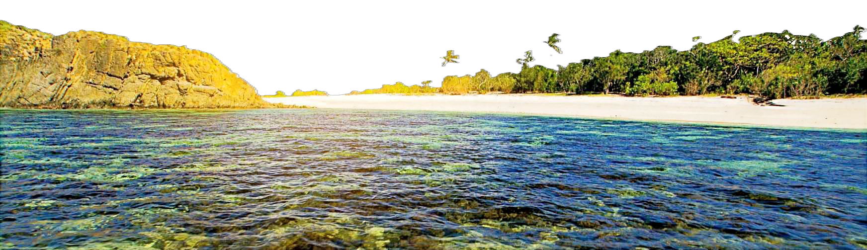
Camarines Sur is hilly and mountainous with a flat central area known as the Bikol plain. It is generally flat at the midsection, between mountain ranges, with other small coastal plains on the northeastern coast. These areas are circumscribed by rolling hills. The ravines are deep, while steep slopes are covered only by cogon. Mangroves and nipa swamps form along both coasts of the province.
The Caramoan peninsula is rough and mountainous with an elevation as high as 904 meters above sea level. The Ragay coast, meanwhile, is hilly and rolling. The province has two inactive volcanoes in its central and southern part, namely Mt. Isarog, with an elevation of 1, 976 meters, and Mt. Iriga, with an elevation of 1, 196 meters.
Two mountain ranges also envelope the province. The Tangkong Baka mountain range, which is the lower portion of the Sierra Madre mountain system, and the Calinigan Mountain Range (904 meters), which is located in the Partido area. Other mountains in the province are Mt. Sugutin (366 meters), Mt. Tiis (610 meters), Saddle Peak (1,028 meters), Triple Peak (638 meters), Mt. Putianay (640 meters), Mt. Elizario (508 meters), and Mt. Talitig (385 meters).
Slope & Elevation
Ranges from flat coastal plains to rugged mountainous terrain. Major peaks include Mt. Isarog (1,966m) and Mt. Iriga (1,196m).
Climate Type
Belongs to Type II Climate (no dry season with very pronounced maximum rain period) and Type IV Climate (rainfall is more or less evenly distributed throughout the year).
Natural Hazards
Susceptible to typhoons, flooding in low-lying areas (Bicol River Basin), and landslides in steep mountainous regions.
Hydrography
Camarines Sur is hilly and mountainous with a flat central area known as the Bikol plain. It is generally flat at the midsection, between mountain ranges, with other small coastal plains on the northeastern coast. These areas are circumscribed by rolling hills. The ravines are deep, while steep slopes are covered only by cogon. Mangroves and nipa swamps form along both coasts of the province.
The Caramoan peninsula is rough and mountainous with an elevation as high as 904 meters above sea level. The Ragay coast, meanwhile, is hilly and rolling. The province has two inactive volcanoes in its central and southern part, namely Mt. Isarog, with an elevation of 1, 976 meters, and Mt. Iriga, with an elevation of 1, 196 meters.
Two mountain ranges also envelope the province. The Tangkong Baka mountain range, which is the lower portion of the Sierra Madre mountain system, and the Calinigan Mountain Range (904 meters), which is located in the Partido area. Other mountains in the province are Mt. Sugutin (366 meters), Mt. Tiis (610 meters), Saddle Peak (1,028 meters), Triple Peak (638 meters), Mt. Putianay (640 meters), Mt. Elizario (508 meters), and Mt. Talitig (385 meters).
Soil
Soil texture ranges from clayey to gravelly. The Bicol plain consists of loam, clay loam, and deposits with silt materials along the banks of the Bicol River. Generally, the surface is moderately dense and compact. The plains and valleys of Camarines Sur are covered by secondary soils, while its hills and mountains are covered by primary soils. The soils of the province are divided into 3 general groups, namely:
A
Soils of plains and valleys
B
Soils of hills and mountains
C
Miscellaneous land types
Land Use
It is the largest among the six provinces of the Bicol Region, with a land area of 526,682 hectares. This is 29.87% of the total area of the Bicol Region and 1.75% of the total area of the Philippines.
Agricultural Areas
Areas devoted to agriculture, such as irrigated and rain-fed lands, crops, and fruit trees.
Grassland & Shrubland
Consists of grasses, shrubs, and pasture lands.
Forest Land
Includes primary and secondary forest lands and kaingin areas.
Wet Land Areas
Consists of mangrove, marshland, and fishponds.
Miscellaneous
Residential, commercial, built-up uses, rivers, lakes, beaches, rocks, volcanic ash.
Land Area
The existing land use of the province may be classified into 5 main categories. Each plays a vital role in our ecosystem and economy.
Key Observation
The existing land use of Camarines Sur is still predominantly agricultural. The next biggest land use in terms of land area is grassland and shrubland.
- Agricultural Areas
- Grassland/Shrubland
- Forest Land
- Wet Land Areas
- Miscellaneous